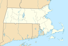
Churchill, Holyoke, Massachusetts
Neighborhood of Holyoke in Massachusetts, United StatesChurchill is a neighborhood in Holyoke, Massachusetts located to the south of the city center, adjacent to the downtown. Its name is a geographic portmanteau as the area was historically known as the Church Hill district prior to its extensive development in the early twentieth century. Located at the southwestern edge of the downtown grid, the area served as housing for mill workers in the late nineteenth and early twentieth century and today contains 166 acres (67 ha) of mixed residential and commercial zoning, including a number of historical brick tenements as well as the headquarters of the Holyoke Housing Authority, Holyoke Senior Center, Churchill Homes public housing, and the Wistariahurst Museum.
Read article
Top Questions
AI generatedMore questions
Nearby Places

Mackenzie Stadium
Baseball venue in Holyoke, Massachusetts, US

Maplewood Hotel
United States historic place

Wistariahurst
Historic house in Massachusetts, United States

Friedrich Block
United States historic place

Clovis Robert Block
United States historic place

Holyoke Testing Flume
Defunct American hydraulic laboratory (1870-1932)

Joseph Allen Skinner Museum

Essex Street Historic District
Historic district in Massachusetts, United States


